Sunday, June 15, 2014

Returning Home

Sunday the 15th, after completing our early summer trip, we made a dash toward Tucson, and home.

During the drive back, we passed by, but did not visit, Bryce Canyon National  Park.  Then we picked up US89, heading south back to Page, Arizona.  We then passed through Flagstaff, Phoenix and on into Saddlebrooke, just north of Tucson.  During our 15 day road trip, we covered over 2,200 miles, and saw our fill of beautiful scenery and interesting historical spots.  We are glad to be home, safe and sound.

While on the 12 hour drive home I received phone calls from each of our two great sons.  A nice Father's Day, and wonderful way to end our trip.

Here are a couple of shots from the Bryce Canyon area.......


Saturday, June 14, 2014

Hell's Backbone

On Saturday the 14th, we drove a "Utah Scenic Backway".


In 1933, the Civilian Conservation Corps. (the CCC) built a 38 mile road from Boulder south to Escalante. It was the only road between the two towns but was not passable in winter.  In 1940,  highway 12 opened as a year around road.  The old CCC road is still able to be driven, and is actually in pretty good shape.  We decided to take the road today, starting just below Boulder off of Hwy 12.  We then drove it all the way back south to Escalante.  The road is called "Hell's Backbone" for the tight ridge it is built upon with sheer drop offs on each side, as much as 1,800 ft in places.  The road carries a warning, "Not for the faint of heart".

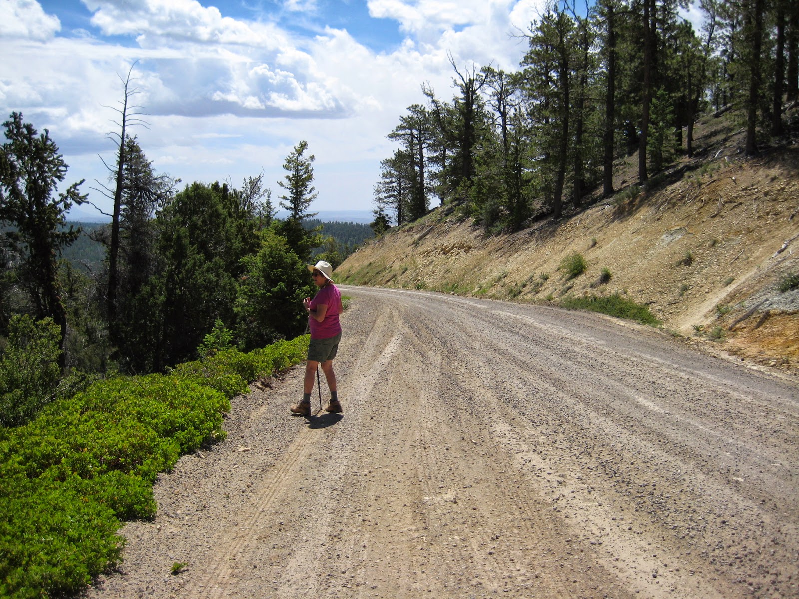
The road climbs to over 9,200 ft, and travels through pinyon/juniper and ponderosa pine forests for the most part, with a few aspens here and there thrown in for good measure.  We cached along the way and found some interesting and challenging cache locations.  If you zoom in on this picture, you can see me pulling out a cache container at a rather precarious spot.


Along the drive you come upon a gorge where the Escalante river flows beneath.  This required the CCC to build a bridge.  The drop off is 1,500 ft at this point.  The story goes that they were using bulldozers, and they got to a point in the bridge construction that they had to get a big compressor from one side of the gorge to the other, but at that point, there was no bridge.  They topped two pine trees and felled them over the gorge.  One fellow agreed to pull the compressor over the two logs using a bulldozer.  They tied a rope around the fellow as a precaution should the vehicles fall to the depths.  The fellow started over, and everyone on each side of the gorge held their breath and prayed.  The fellow made it.

The old wooden CCC bridge served until cars traveling over it began producing creaking noises within the bridge.  It was then replaced with a more modern bridge, but only recently.  Regardless, the drop offs are the same.  From the bridge you can look down into Box Death Hollow Wilderness area.  That name alone gives me a chill.  We took some pictures here, but it is really difficult to capture the area in a photo.


When we made it back to Escalante, we enjoyed a great BLT sandwich at a local outfitters/restaurant, and then Kathy took a historic walking tour of Escalante, while I hunkered down behind the PC to log caches and work on the blog.

It was windy on the ridge today
:-)


Friday, June 13, 2014

Escalante

This Friday the 13th, we traveled from Torrey, south and west to the little town of Escalante.  There is a river nearby called Escalante, named for a Spanish Franciscan missionary/explorer, Silvestre Velez de  Escalante.  The town is named after the river.

The drive down followed the very scenic Highway 12.  Along the way, we passed through Boulder, and pulled the little trailer over mountains in the Dixie National Forest, including a 9,600 ft summit, and then down some fairly hair raising ridge tops, with great drop offs at each side.   There were many amazing overlooks on this drive, and the scenery was breathtaking.


Just outside the town of Escalante are a couple of back country drives.  One heads north and is called Hell's Backbone, which we intend to try in the morning.  Another, probably more famous, is the road southeast to Hole in the Rock.  Unfortunately, the road condition for that drive would not permit our truck to make it.

Hole in the rock is significant historically.  It is said to be the scene of the last major wagon train trip in America.  250 Mormon settlers, (men, women and children) in 1879 were finding their way southwest from Escalante to establish a new town on the San Juan River in Southeast Utah.  Their travel from Escalante was tough enough for the first 55 miles, but they never expected the 1,800 ft vertical drop they would  have to make when they reached the Colorado River gorge.  They found a vertical crack leading down, which they widened with hand picks over a six week period, making it barely passable for a wagon, and only if you took in the wagon's water barrels from the sides.  On January 26, 1880, leaving the children at the top, the wagons were lowered with horses, and with 20 men struggling at the back of each wagon holding ropes, trying to keep it  from falling the near vertical drop.   After getting a wagon down, they went back up to help the children down. Once they got all the wagons down, the party faced crossing the untamed Colorado.  After that, they spent the next 2 months and 140 miles crossing frozen slickrock, cedar forest, muck, cactus and snow before reaching their destination on the San Juan River.  There they established the new community of Bluff.

I was disappointed that I could not drive there to see the drop down into what is now Lake Powell, but maybe another time.  The pictures below were taken from the internet.


Hole In The Rock, today

Hole In The Rock, today

In Escalante there is a special Heritage Center dedicated to the Mormon Settlers who established southern Utah, (as well as many other areas of the Southwest), including their trials at Hole In The Rock. There we met two kindly and well informed gentlemen, and saw a brief film.  The Heritage Center gave me a glimpse of the tenacity and bravery of the Mormon settlers. Had I known the whole story of how folks came to settle Bluff, I would have paid more attention when we drove through that town a couple of weeks ago.


Thursday, June 12, 2014

Grand Wash


The early morning in shadows

Thursday the 12th, we rose early and got out quick.  We were both excited.  Our plan was to walk the Grand Wash in Capitol Reef National Park.  

We have taken this walk a couple of times before, and to me, it is the best of all day hikes.  I don't know how, or where you would find anything to beat it.  We arrived around 7:30 am at the trail head on Hwy 24 east of the visitor center by a few miles.  Grand Wash is a 5 mile round trip walk, but to my liking it is relatively level with little elevation change.  We were the first to arrive that morning, and indeed, until we reached the halfway point, we didn't see another person .  As we returning back down the wash, we ran into more and more people as the sun rose higher.   

The early morning was glorious.  It was cool enough for me to wear a windbreaker and long pants.  The shadows as the sun began its climb highlighted the character of the cliffs and rock formations.  Above, the sky was a true Western blue. The mighty rock walls on each side of the wash at times tower 300 to 400 feet on each side, and narrow in on you near the middle of the walk.  All that is heard is the light wind,  and the songs of the cliff swallows and the canyon wrens.  We strolled slowly and took in as much of it as we could, stopping often to point at one spectacular view after another.  We saw trees growing out of what seemed to be sheer rock, beautiful flowers of many types, and rocks carved by wind and water that no human artist could match.


As we moved through the wash, I began to think a nickname for this hike might be the Wow! Walk.  We said "Wow" pretty often as we walked along.  This day hike alone is worth the trip to Capitol Reef National Park.  What a great morning.


Maintenance Day

Maintenance Day
Maintenance Day
That's all I really wanted to say
                                  Paul Simon (almost)

Wednesday the 11th, we did travel maintenance.  We moved camp to another RV park down the road for a change of scenery.  Four loads of laundry were completed, as well as some clean up around the trailer.

The skies were on and off dark during the day with a 30 percent chance of thundershowers, which materialized into a single thunder clap and a couple of short periods of drizzle.  We did get a minor amount of caching in, and we investigated several pieces of property for sale in the area.  This real estate investigation is a regular thing with us as we travel.  The proverbial "What if?" question is always with us I guess.  We finished off the day with a wonderful dinner at a local hangout called the Rim Rock Patio.

Here is one of the views from our new camp spot.

Tuesday, June 10, 2014

The High Country


Tuesday the 10th, we decided to check out the area northwest of Torrey, in search of possible dispersed camping sites for use in the future, hopefully near lakes.  We were not disappointed.

The day trip took us into the high country within the Fishlake National Forest.  We were driving over the 8,000 ft mark, and into some beautiful sage covered mountains, which featured many little lakes and reservoirs.  Sites for dispersed camping (with no hookups) abound in the area, and the best part is that the camping is free.

A nice location we came upon was Forsyth Reservoir.  There were many sites that would take multiple camping units, right along the lake.  Paved all the way in from Highway 72, it would be an easy entrance and exit with a camping trailer.  The skies would be dark, and campfires were permitted.  The distant highway rarely had a passing car even during the day, and the lake was void of people, with the exception of a couple of  fishermen out in small  boats.   This is one place we will note for the future.


Susan D, our friend from back home, being a amateur geologist, would  love walking through the low sage plants in the area.  The entire valley seems to have been created by glacial movement, leaving the ground covered with small, partially rounded rocks...  much like a riverbed.  The variety of the little stones were amazing, and beautiful.  We were caching in the area, and as we hiked out through  the sage, we each found ourselves stopping often to grab another cool stone of one kind or another.  You would  love it Susan.


One of the curious things we saw during our drive into to the high country was a single sheep and its lamb along the side of the road, just standing there as if  they were surveying the nearby hills and farmland.


Before heading back to the campground, we decided to travel into the National Park in search of a good picnic area.  We finally had lunch outside a little nature center down near the Fremont River, but the lunch was rushed due to no-see-ums that are traveling through the river area during the two week period we happen to be here.  :-(   Yuck!  Hate these guys.....  Thank heavens they are not on the trails.

The biting midge, (no-see-um)


Monday, June 9, 2014

Setting up in Torrey

The Waterpocket Fold

Monday the 9th we traveled from Moab to the tiny town of Torrey, Utah.   Torrey is in the south central part of the state, and just west of maybe our favorite summer vacation spot, Capitol Reef National Park.   It is a long narrow park that runs roughly north and south for 100 miles.  About 75 miles of the park preserves a long up-thrust called the Waterpocket Fold.  It is a rugged spine extending from Thousand Lake Mountain, all the way south to Lake Powell.  Some of the most wild and spectacular scenery I have ever seen is in this area.  One of the best things about this park is that it is little visited, at least vs. some of the other famous national parks in southern Utah...  such as Bryce, Zion, Arches etc.  This means when you take a hike in the park, you are not likely to run into 350 other people along the way.


We have been here six times previous to this.  Each time, we have enjoyed the visit thoroughly.  Our camp for the next two nights will be at a little private RV park, with 12 spaces here in Torrey.  It is a little rough, but you can see some great cliffs off in the distance, and it is relatively quiet.  After arriving and setting up camp, we had lunch, and then went for a few caches just to get us out walking and hiking a bit.  Now, we are sitting in the shade by our camper trailer, reading, blogging, and enjoying the afternoon.  Tomorrow we will likely hike, cache, and sit in the shade by our camper trailer, reading, blogging, and enjoying the afternoon.  :-)  What's not to like?  76 degrees in the shade.


A window view from inside our camper trailer


Sunday, June 8, 2014

Really Indescribable


On Sunday, June 8, the morning skies were dark as we left Moab and traveled into Canyonlands National Park.  We came upon the indescribable.  

Canyonlands National Park is in an area of the country riddled with thousands of canyons, mesas, hoodoos, bluffs, cliffs, spires, chimneys, and all forms of rock formations.  What it has few of is roads leading into the area.  Paved roads you can count on one half of one hand.  The park itself spreads over 527 square miles, and was the last area in the continental United States to be mapped.  The entire southern half of the park is called the Maze, and for good reason.  The gnarled mess of canyons is so vast, that it became an area of hideouts for bandits into the 20th century.  The Colorado and Green rivers meet within the park, to continue south as the mighty Colorado.

As the skies began to clear, we took the paved road that enters from the northern end of the park.  It goes part way south along a string of mesa tops, so mostly what we saw was from overlooks.  The scale of the landscape is, well, really indescribable.  Indeed it is so grand, that it is mind boggling, at least for me.  We were able at one overlook to see the Green River way down below, before it meets up with the Colorado.  There are a few dirt roads that drop into some of the canyons, and enter from several sides of the park.  One is 100 miles long, and requires a two day trip with high clearance and four wheel drive.  

We did a little geocaching in the morning coming up to the park, but very little.  Geocaches are not allowed in National Parks, so we were out of the environment.  In the park, we mostly we just gawked at one stupendous overlook, then another, and another, until we both were on overload.  Then we headed back to Moab to buy some supplies, and get ready for our move in the morning toward Capitol Reef National Park, and Torrey, Utah.  Here are a few shots from today, but I can tell you up front, most of what we saw was bigger than my little camera could take in. 

(look for the SUV in the first photo below)


Cryptobiotic Soil

Okay...  here is your science lesson for toady.  Read only if you are interested.  :-)

Cryptobiotic soil makes bushwhacking difficult in this area.  You have to be very, very careful where you step.  By the way, this living soil is also found in the Sedona area.  When I worked in Sedona, damage to this life form by unknowing urban folks was a constant problem.  If you ever wondered why the Sedona area has so many trails, this stuff is the reason.

Here is a picture that I took yesterday in Castle Rock Valley of cryptobiotic soil.  Zoom in the picture for a closer look.


Cryptobiotic soil crust is a living groundcover that forms the foundation of high desert plant life. This knobby, black crust is dominated by cyanobacteria, but also includes lichens, mosses, green algae, microfungi and bacteria.
Cyanobacteria, previously called blue-green algae, are one of the oldest known life forms. It is thought that these organisms were among the first land colonizers of the earth's early land masses, and played an integral role in the formation and stabilization of the earth's early soils. Extremely thick mats of these organisms converted the earth's original carbon dioxide-rich atmosphere into one rich in oxygen and capable of sustaining life.
When wet, Cyanobacteria move through the soil and bind rock or soil particles, forming an intricate web of fibers. In this way, loose soil particles are joined together, and an otherwise unstable surface becomes very resistant to both wind and water erosion. The soil-binding action is not dependent on the presence of living filaments. Layers of abandoned sheaths, built up over long periods of time, can still be found clinging tenaciously to soil particles, providing cohesion and stability in sandy soils at depths up to 10cm.
Nitrogen fixation is another significant capability of cyanobacteria. Vascular plants are unable to utilize nitrogen as it occurs in the atmosphere. Cyanobacteria are able to convert atmospheric nitrogen to a form plants can use. This is especially important in desert ecosystems, where nitrogen levels are low and often limiting to plant productivity.
Soil crusts have other functions as well, including an ability to intercept and store water, nutrients and organic matter that might otherwise be unavailable to plants.
Unfortunately, many human activities negatively affect the presence and health of soil crusts. Compressional stresses placed on them by footprints or machinery are extremely harmful, especially when the crusts are dry and brittle. Tracks in continuous strips, such as those produced by vehicles or bicycles, create areas that are highly vulnerable to wind and water erosion. Rainfall carries away loose material, often creating channels along these tracks, especially on slopes.
Impacted areas may never fully recover. Under the best circumstances, a thin veneer of cryptobiotic soil may return in five to seven years. Damage done to the sheath material, and the accompanying loss of soil nutrients, is repaired slowly during up to 50 years of cyanobacterial growth. Lichens and mosses may take even longer to recover.

Saturday, June 7, 2014

La Sal Mountain Scenic Loop


On Saturday, June 7, we decided to visit the high country near Moab.  This meant traveling into the relatively nearby La Sal Mountains.  We took what is called the La Sal Mountain Scenic Loop Road to the north east, which turned out to be a sixty mile loop from town, re-entering the Moab area south of town, near our RV park.  

The road was paved, but slightly wider than a single lane road.  Varied and beautiful all the way, it starts out following the Colorado River going east from town, then turns, and follows Castle Rock Valley, toward the La Sal Mountains.  It climbs from there, and we managed to get into some rather cool country for our lunch break.  We dined at 8,800 ft among the aspens and spruce.  Then, we fell in altitude in the afternoon, returning to Moab, passing ranching areas, streams and lakes.  Of course we cached along the way, which forced us out of the car often to climb the mountain sides, and hike into the woods in search of cache treasure.  This was an area we had never seen around Moab, and we throughly enjoyed the trip.  Nice day.

In the first two shots below, taken from different cache locations, see if you can spy our white truck, to give you some perspective.